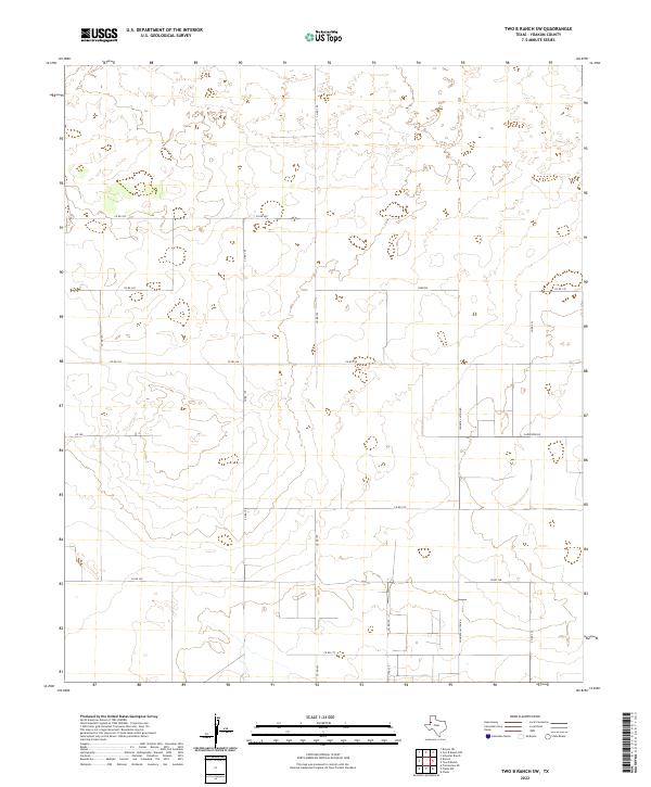
2022 Map of Two B Ranch SW
USGS Topo · Published 2022About this map
Yoakum County's open high plains character is defined here by a systematic grid of section roads and expansive, unpopulated ranchland. The landscape is marked by a network of local routes including Co Rd 195, Co Rd 175, and Co Rd 130, which provide the primary access to this interior portion of the Llano Estacado. Named local landmarks such as Johnnie Layton Rd and Carpenter Rd suggest the long-standing agricultural and ranching heritage of the area. Topographically, the map reveals subtle elevation changes typical of the Texas Panhandle, with small depressions and gradual rises that dictate the placement of ranch infrastructure. This specific area, west of the county seat, remains largely undeveloped, preserving the spatial layout of larger land holdings established in the mid-20th century.
Find a feature on this map
16 named features on this map. Tap any name to fly to it.
Don’t see what you’re looking for? This feature index may not catch every label — zoom into the map to look around manually.
Map Details
Editions of this 2022 Two B Ranch SW Map
This is the sole edition of this map. No revisions or reprints were ever made.
Other maps of this area

1954 · Brownfield
USGS Topo · 1:250,000

1958 · Brownfield
USGS Topo · 1:250,000

1962 · Brownfield
USGS Topo · 1:250,000

1970 · Prairieview NE
USGS Topo · 1:24,000

1970 · Bronco NE
USGS Topo · 1:24,000

1970 · Bronco
USGS Topo · 1:24,000

1971 · Plains NW
USGS Topo · 1:24,000

1971 · Schooler Ranch
USGS Topo · 1:24,000
1971 · Plains
USGS Topo · 1:24,000
1971 · Two B Ranch
USGS Topo · 1:24,000