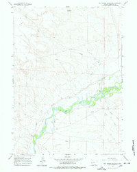
1964 Map of Two Buttes Reservoir
USGS Topo · Published 1978About this map
The New Fork River winds through the high desert landscape of Sublette County, defining the agricultural and industrial character of the region in the early 1960s. This survey illustrates a complex network of irrigation infrastructure essential for ranching, including the Paradise Ditch, Griffin No 2 Ditch, and Bertram Ditch. These waterways contrast with the arid prominence of The Mesa to the northwest. Land use in this era is further evidenced by the Blue Rim Drift Fence, a significant pastoral boundary, and several gas wells indicating the area's energy development. Local topography is shaped by numerous ephemeral drainages such as Lovatt Draw and Alkali Creek, while the Two Buttes Reservoir stands as a primary water storage feature in the northern portion of the quadrangle.
Find a feature on this map
13 named features on this map. Tap any name to fly to it.
Don’t see what you’re looking for? This feature index may not catch every label — zoom into the map to look around manually.
Map Details
Editions of this 1964 Two Buttes Reservoir Map
2 editions found
Other maps of this area

1955 · Lander
USGS Topo · 1:250,000

1958 · Lander
USGS Topo · 1:250,000

1961 · Lander
USGS Topo · 1:250,000

1964 · Two Buttes Reservoir
USGS Topo · 1:24,000

1964 · Ross Butte
USGS Topo · 1:24,000

1964 · Boulder Lake
USGS Topo · 1:24,000
1964 · Olsen Ranch
USGS Topo · 1:24,000

1964 · Mount Airy
USGS Topo · 1:24,000

1964 · Mesa Spring
USGS Topo · 1:24,000

1964 · Boulder
USGS Topo · 1:24,000