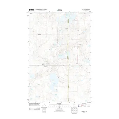
2013 Map of Two Inlets
USGS Topo · Published 2013About this map
The boundary between Becker and Hubbard counties cuts vertically through this lake-rich Minnesota landscape, where the settlement of Arago serves as a small crossroads hub. The area is defined by its glacial hydrology, with Two Inlets Lake and Little Mantrap Lake surrounded by a dense network of smaller basins like Hungry Man Lakes, Dinner Lake, and Rose Lake. This mid-2013 survey reflects a region deeply oriented toward seasonal recreation and permanent residence, evidenced by the Wilderness Bay Resort and RV Campground and the Brookside Golf Course located just north of Little Mud Lake.
Find a feature on this map
54 named features on this map. Tap any name to fly to it.
Don’t see what you’re looking for? This feature index may not catch every label — zoom into the map to look around manually.
Map Details
Editions of this 2013 Two Inlets Map
This is the sole edition of this map. No revisions or reprints were ever made.
Other maps of this area

1953 · Brainerd
USGS Topo · 1:250,000

1954 · Bemidji
USGS Topo · 1:250,000

1957 · Brainerd
USGS Topo · 1:250,000

1957 · Bemidji
USGS Topo · 1:250,000

1958 · Bemidji
USGS Topo · 1:250,000

1958 · Brainerd
USGS Topo · 1:250,000

1965 · Brainerd
USGS Topo · 1:250,000

1969 · Park Rapids
USGS Topo · 1:24,000

1969 · Anchor Hill
USGS Topo · 1:24,000

1969 · Big Basswood Lake
USGS Topo · 1:24,000