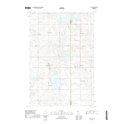
2019 Map of Two Inlets
USGS Topo · Published 2019About this map
Two Inlets and the surrounding lake country of northern Minnesota are defined by a complex network of glacial water bodies and wetlands straddling the border of Becker and Hubbard Counties. The landscape is dominated by large basins including Two Inlets Lake, Dinner Lake, and the expansive Hungry Man Lakes, which are linked by smaller watercourses such as Dinner Creek and Basswood Cr. Small rural settlements like Arago and Goldenrod are connected by a grid of county roads and forest trails, reflecting a community deeply tied to the natural timber and lake environment. Cultural landmarks like Saint Mary's Catholic Cemetery near the heart of Two Inlets and the Evergreen Cemetery to the east provide specific points of interest for genealogical research in this sparsely populated region. The intricate shoreline of Little Mantrap Lake in the northeast corner further illustrates the glacial character of the terrain.
Find a feature on this map
73 named features on this map. Tap any name to fly to it.
Don’t see what you’re looking for? This feature index may not catch every label — zoom into the map to look around manually.
Map Details
Editions of this 2019 Two Inlets Map
This is the sole edition of this map. No revisions or reprints were ever made.
Other maps of this area

1953 · Brainerd
USGS Topo · 1:250,000

1954 · Bemidji
USGS Topo · 1:250,000

1957 · Brainerd
USGS Topo · 1:250,000

1957 · Bemidji
USGS Topo · 1:250,000

1958 · Bemidji
USGS Topo · 1:250,000

1958 · Brainerd
USGS Topo · 1:250,000

1965 · Brainerd
USGS Topo · 1:250,000

1969 · Park Rapids
USGS Topo · 1:24,000

1969 · Anchor Hill
USGS Topo · 1:24,000

1969 · Big Basswood Lake
USGS Topo · 1:24,000