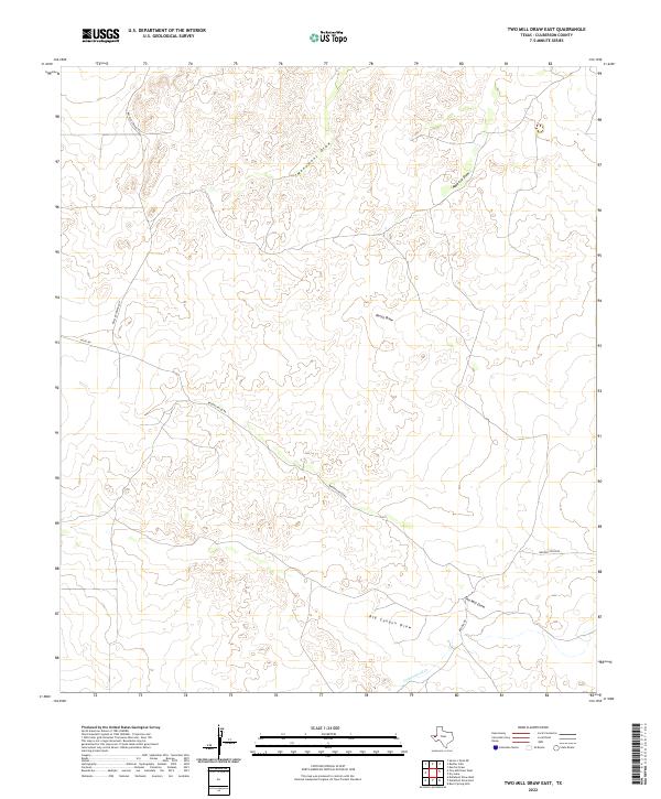
2022 Map of Two Mill Draw East
USGS Topo · Published 2022About this map
Monument Draw and Maverick Draw define the drainage patterns across this arid stretch of Culberson County. The landscape is characterized by its significant draws, including Dutch Draw and Big Canyon Draw, which suggest a terrain shaped by intermittent water flow through West Texas limestone and soil. Human presence is marked primarily by ranching and transit corridors such as Rustler Springs Rd and Brooks-Pecos Rd, which wind through the contours of the high desert. In the southern portion of the quadrangle, Cottonwood Cr joins with Two Mill Draw, indicating a convergence of seasonal waterways. The network of unimproved roads like Nevel Rd and Brooks Rd provide the only access points to this sparse, open territory, reflecting the enduringly rural character of the region into the twenty-first century.
Find a feature on this map
10 named features on this map. Tap any name to fly to it.
Don’t see what you’re looking for? This feature index may not catch every label — zoom into the map to look around manually.
Map Details
Editions of this 2022 Two Mill Draw East Map
This is the sole edition of this map. No revisions or reprints were ever made.
Other maps of this area

1928 · Kent
USGS Topo · 1:125,000

1954 · Van Horn
USGS Topo · 1:250,000

1958 · Van Horn
USGS Topo · 1:250,000

1973 · Dellahunt Draw West
USGS Topo · 1:24,000

1973 · Two Mill Draw West
USGS Topo · 1:24,000

1973 · Seven L Peak NE
USGS Topo · 1:24,000

1973 · Rustler Hills
USGS Topo · 1:24,000
1973 · Dellahunt Draw East
USGS Topo · 1:24,000
1973 · Dry Lake
USGS Topo · 1:24,000
1973 · Derrick Draw
USGS Topo · 1:24,000