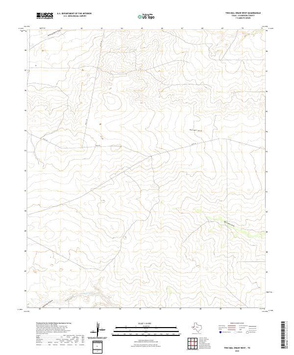
2022 Map of Two Mill Draw West
USGS Topo · Published 2022About this map
Two Mill Draw and Big Canyon Draw carve through this high-desert plateau in Culberson County, defining a landscape shaped by intermittent water flow and seasonal drainage patterns. The map detail reflects a sparsely populated ranching territory where local infrastructure is limited to long-distance ranch roads such as Seven L Rd and Nevel Rd. These routes provide the primary access through the arid terrain, connecting the various draws that converge toward the southern boundary. To the north and south, geographic features like Running Water Draw, Cottonwood Cr, and Paint Horse Draw reveal the fundamental drainage network of the Trans-Pecos region. This survey captures the topographical reality of West Texas land use in the early twenty-first century, emphasizing natural watercourses and established cattle-country thoroughfares over concentrated settlement.
Find a feature on this map
7 named features on this map. Tap any name to fly to it.
Don’t see what you’re looking for? This feature index may not catch every label — zoom into the map to look around manually.
Map Details
Editions of this 2022 Two Mill Draw West Map
This is the sole edition of this map. No revisions or reprints were ever made.
Other maps of this area

1928 · Kent
USGS Topo · 1:125,000

1954 · Van Horn
USGS Topo · 1:250,000

1958 · Van Horn
USGS Topo · 1:250,000

1973 · Dellahunt Draw West
USGS Topo · 1:24,000

1973 · Seven L Peak
USGS Topo · 1:24,000

1973 · Two Mill Draw West
USGS Topo · 1:24,000

1973 · Seven L Peak NE
USGS Topo · 1:24,000

1973 · Rustler Hills
USGS Topo · 1:24,000

1973 · K C Ranch
USGS Topo · 1:24,000
1973 · Dellahunt Draw East
USGS Topo · 1:24,000