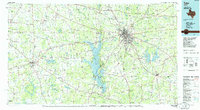
1985 Map of Tyler
USGS Topo · Published 1985About this map
Tyler serves as the regional hub of East Texas in this mid-1980s landscape, where the expanding city is surrounded by a network of smaller communities including Athens, Jacksonville, and Whitehouse. The central feature of the region is the massive Lake Palestine, formed by the damming of the Neches River, which creates a complex shoreline dotted with settlements like Frankston and Chandler. This era captures the transition of the local economy, shown through the presence of a Gas Plant and Refinery alongside established institutions like Tyler Junior College.
Find a feature on this map
218 named features on this map. Tap any name to fly to it.
Don’t see what you’re looking for? This feature index may not catch every label — zoom into the map to look around manually.
Map Details
Editions of this 1985 Tyler Map
This is the sole edition of this map. No revisions or reprints were ever made.
Other maps of this area

1920 · Kemp
USGS Topo · 1:62,500

1935 · Henderson
USGS Topo · 1:48,000

1936 · Kilgore
USGS Topo · 1:48,000

1937 · Troupe
USGS Topo · 1:48,000

1938 · Winona
USGS Topo · 1:48,000

1939 · Henderson
USGS Topo · 1:62,500

1940 · Kilgore
USGS Topo · 1:62,500

1943 · Troup
USGS Topo · 1:62,500

1943 · Winona
USGS Topo · 1:62,500

1943 · Cushing
USGS Topo · 1:62,500