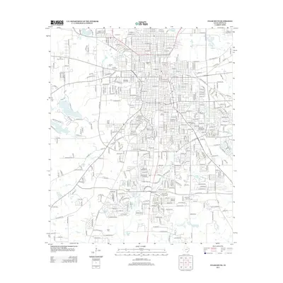
2012 Map of Tyler South
USGS Topo · Published 2012About this map
Oakwood Cem and Rose Hill Cem anchor the historic central core of Tyler, Texas, in this 2012 topographic survey. The urban landscape is marked by long-standing institutions like Texas Coll and the sprawling East Texas Fairground, while the western edge transitions into recreational and natural spaces around Bellwood Lake and Greenbriar Lake. For genealogists, the map is particularly valuable for its precise location of numerous burial grounds, including the Ahavath Achim Cem, Saint Louis Cem, and the more remote Kendrick Cem and Smith Cem further south.
Find a feature on this map
423 named features on this map. Tap any name to fly to it.
Don’t see what you’re looking for? This feature index may not catch every label — zoom into the map to look around manually.
Map Details
Editions of this 2012 Tyler South Map
This is the sole edition of this map. No revisions or reprints were ever made.
Other maps of this area

1937 · Troupe
USGS Topo · 1:48,000

1938 · Winona
USGS Topo · 1:48,000

1943 · Troup
USGS Topo · 1:62,500

1943 · Winona
USGS Topo · 1:62,500

1946 · Bullard
USGS Topo · 1:62,500

1948 · Bullard
USGS Topo · 1:62,500

1948 · Tyler
USGS Topo · 1:62,500

1949 · Tyler
USGS Topo · 1:62,500

1956 · Tyler
USGS Topo · 1:250,000

1966 · Chandler
USGS Topo · 1:24,000