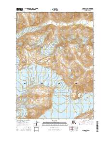
2016 Map of Tyonek A-7 SE
USGS Topo · Published 2016About this map
The McArthur River winds through the northern reaches of this glacial territory on the Kenai Peninsula, where the landscape is defined by massive ice formations. In the northwestern corner, the McArthur Glacier marks the high alpine terrain, while the Blockade Glacier occupies a central position, illustrating the natural barriers that shape this part of the Alaska-Kenai Peninsula Borough. This map captures the topography of a region largely devoid of human infrastructure, focusing instead on the dramatic elevation changes and the hydrological patterns established by these moving ice sheets and their subsequent outwash.
Find a feature on this map
9 named features on this map. Tap any name to fly to it.
Don’t see what you’re looking for? This feature index may not catch every label — zoom into the map to look around manually.
Map Details
Editions of this 2016 Tyonek A-7 SE Map
This is the sole edition of this map. No revisions or reprints were ever made.
Other maps of this area

1944 · Kenai
USGS Topo · 1:250,000

1949 · Tyonek
USGS Topo · 1:250,000

1950 · Kenai
USGS Topo · 1:250,000

1951 · Tyonek
USGS Topo · 1:250,000

1958 · Tyonek A-6
USGS Topo · 1:63,360

1958 · Kenai D-6
USGS Topo · 1:63,360

1958 · Kenai D-7
USGS Topo · 1:63,360

1958 · Tyonek
USGS Topo · 1:250,000
1958 · Tyonek A-7
USGS Topo · 1:63,360

1958 · Kenai
USGS Topo · 1:250,000