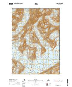
2017 Map of Tyonek A-7 SW
USGS Topo · Published 2017About this map
The high ice and steep slopes of the Aleutian Range dominate this corner of the Kenai Peninsula. In this 2017 study, the slow movement of the glacial landscape is evidenced by the positioning of McArthur Glacier in the northeast and Blockade Glacier in the south-central sections. The terrain is defined by extreme elevation changes, with few human-made landmarks present, focusing instead on the natural borders of the Public Land Survey System as defined by townships like t12n r19w and t11n r18w. This map serves as a primary record of the glacial extent and topographic contours in a region where the environment remains the primary architect of the land's character.
Find a feature on this map
7 named features on this map. Tap any name to fly to it.
Don’t see what you’re looking for? This feature index may not catch every label — zoom into the map to look around manually.
Map Details
Editions of this 2017 Tyonek A-7 SW Map
This is the sole edition of this map. No revisions or reprints were ever made.
Other maps of this area

1944 · Kenai
USGS Topo · 1:250,000

1949 · Tyonek
USGS Topo · 1:250,000

1950 · Kenai
USGS Topo · 1:250,000

1951 · Tyonek
USGS Topo · 1:250,000

1958 · Kenai D-8
USGS Topo · 1:63,360

1958 · Kenai D-7
USGS Topo · 1:63,360

1958 · Tyonek
USGS Topo · 1:250,000

1958 · Tyonek A-8
USGS Topo · 1:63,360
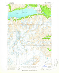
1958 · Tyonek A-7
USGS Topo · 1:63,360

1958 · Kenai
USGS Topo · 1:250,000