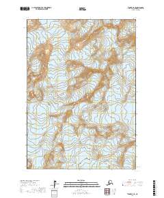
2017 Map of Tyonek A-8 SE
USGS Topo · Published 2017About this map
Shamrock Glacier and Blockade Glacier define this high-altitude landscape within the Kenai Peninsula Borough, as recorded in this 2017 study by the U.S. Geological Survey. The terrain is characterized by steep elevation changes and the massive glacial flows of the Tanaina Glacier, which dominate the southwestern corner of the quadrangle.
Find a feature on this map
7 named features on this map. Tap any name to fly to it.
Don’t see what you’re looking for? This feature index may not catch every label — zoom into the map to look around manually.
Map Details
Editions of this 2017 Tyonek A-8 SE Map
This is the sole edition of this map. No revisions or reprints were ever made.
Other maps of this area

1944 · Kenai
USGS Topo · 1:250,000

1949 · Tyonek
USGS Topo · 1:250,000

1950 · Kenai
USGS Topo · 1:250,000

1951 · Tyonek
USGS Topo · 1:250,000

1958 · Kenai D-8
USGS Topo · 1:63,360

1958 · Kenai D-7
USGS Topo · 1:63,360

1958 · Tyonek
USGS Topo · 1:250,000

1958 · Tyonek A-8
USGS Topo · 1:63,360
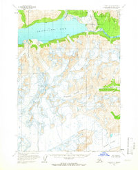
1958 · Tyonek A-7
USGS Topo · 1:63,360

1958 · Kenai
USGS Topo · 1:250,000