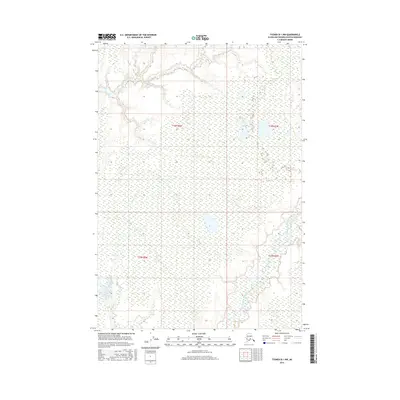
2016 Map of Tyonek B-1 NW
USGS Topo · Published 2016About this map
The Little Susitna River meanders through the eastern portion of this quadrangle, forming complex oxbows and channels that define the local hydrology. This 2016 survey, produced by the U.S. Geological Survey, reflects the wetland-dominated landscape typical of the Matanuska-Susitna region. In the western reaches, the drainage of McGuire Creek and Fish Creek further shapes the terrain. The map is largely defined by its natural water features and extensive marshlands, showing very little in the way of human infrastructure or road networks. The intricate survey of these water bodies highlights the shifting nature of the river systems in this part of Alaska, providing a detailed look at the drainage patterns before potential future development or environmental change.
Find a feature on this map
8 named features on this map. Tap any name to fly to it.
Don’t see what you’re looking for? This feature index may not catch every label — zoom into the map to look around manually.
Map Details
Editions of this 2016 Tyonek B-1 NW Map
This is the sole edition of this map. No revisions or reprints were ever made.
Other maps of this area

1949 · Tyonek
USGS Topo · 1:250,000

1951 · Tyonek
USGS Topo · 1:250,000

1952 · Tyonek C-1
USGS Topo · 1:63,360

1958 · Tyonek C-2
USGS Topo · 1:63,360

1958 · Tyonek B-1
USGS Topo · 1:63,360

1958 · Tyonek B-2
USGS Topo · 1:63,360

1958 · Tyonek C-1
USGS Topo · 1:63,360

1958 · Tyonek
USGS Topo · 1:250,000

1965 · Tyonek
USGS Topo · 1:250,000
1979 · Tyonek B-1 NE
USGS Topo · 1:25,000