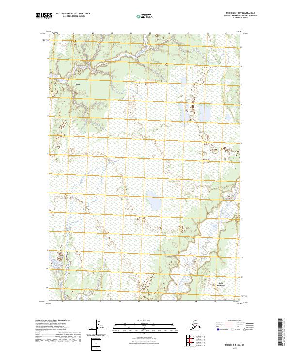
2023 Map of Tyonek B-1 NW
USGS Topo · Published 2023About this map
The Susitna settlement area and the surrounding wetlands of the Matanuska-Susitna Borough are documented in this 2023 survey. This landscape is defined by the braided drainage patterns of the Little Susitna River and Fish Creek, which carve through a dense network of marshes and low-lying coastal plains near Point MacKenzie. The map provides a high-resolution view of the modern hydrological state of the region, where the Maguire Creek drainage feeds into a complex system of lakes and ponds. While the terrain is largely defined by its natural water features, the inclusion of the Public Land Survey System boundaries, including t16n r6w and t15n r5w, helps genealogists and land researchers pinpoint specific historical homesteading and allotment locations within these townships. The vast wetland designations from the National Wetlands Inventory reveal the delicate balance of the Susitna river basin's contemporary geography.
Find a feature on this map
9 named features on this map. Tap any name to fly to it.
Don’t see what you’re looking for? This feature index may not catch every label — zoom into the map to look around manually.
Map Details
Editions of this 2023 Tyonek B-1 NW Map
This is the sole edition of this map. No revisions or reprints were ever made.
Other maps of this area

1949 · Tyonek
USGS Topo · 1:250,000

1951 · Tyonek
USGS Topo · 1:250,000

1952 · Tyonek C-1
USGS Topo · 1:63,360

1958 · Tyonek C-2
USGS Topo · 1:63,360

1958 · Tyonek B-1
USGS Topo · 1:63,360

1958 · Tyonek B-2
USGS Topo · 1:63,360

1958 · Tyonek C-1
USGS Topo · 1:63,360

1958 · Tyonek
USGS Topo · 1:250,000

1965 · Tyonek
USGS Topo · 1:250,000
1979 · Tyonek B-1 NE
USGS Topo · 1:25,000