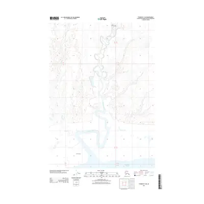
2013 Map of Tyonek B-1 SW
USGS Topo · Published 2013About this map
Little Susitna River meanders across this coastal terrain in the Matanuska-Susitna Borough, revealing a complex network of waterways before reaching the Pacific Ocean. This 2013 survey illustrates the low-lying Susitna Flats, where numerous small ponds and marshy areas characterize the landscape. To the north, the Little Susitna Airport provides a point of access to this sparsely settled region. The presence of Maguire Cr flowing into the main river channel highlights the intricate drainage patterns of the Alaskan coastal plain. This map is particularly useful for understanding the hydrography of the Cook Inlet area, showing how the river systems interact with the tidal influence of the ocean at the southern edge of the sheet.
Find a feature on this map
11 named features on this map. Tap any name to fly to it.
Don’t see what you’re looking for? This feature index may not catch every label — zoom into the map to look around manually.
Map Details
Editions of this 2013 Tyonek B-1 SW Map
This is the sole edition of this map. No revisions or reprints were ever made.
Other maps of this area

1949 · Tyonek
USGS Topo · 1:250,000

1951 · Tyonek
USGS Topo · 1:250,000

1951 · Tyonek A-2
USGS Topo · 1:63,360

1951 · Tyonek A-1
USGS Topo · 1:63,360

1952 · Tyonek A-2
USGS Topo · 1:63,360

1952 · Tyonek A-1
USGS Topo · 1:63,360

1958 · Tyonek B-1
USGS Topo · 1:63,360

1958 · Tyonek B-2
USGS Topo · 1:63,360

1958 · Tyonek
USGS Topo · 1:250,000

1965 · Tyonek
USGS Topo · 1:250,000