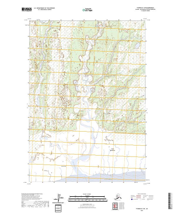
2023 Map of Tyonek B-1 SW
USGS Topo · Published 2023About this map
The Little Susitna River meanders south through a vast network of wetlands before reaching the glacial waters of Cook Inlet. This coastal landscape is dominated by the Susitna Flats, a wide expanse of tidal marsh and alluvial deposits that defines the western edge of the Matanuska-Susitna region. While the terrain is largely uninhabited, the presence of the Little Susitna Airport in the northern reach suggests the importance of bush aviation for access to these remote wetlands. Near the southern shore, Point MacKenzie stands as a prominent coastal landmark, flanked by the seasonal drainage of Maguire Creek. The map provides a high-resolution look at the shifting channels and hydrological patterns of the river delta, reflecting the dynamic nature of the Alaskan coast in the 2020s.
Find a feature on this map
12 named features on this map. Tap any name to fly to it.
Don’t see what you’re looking for? This feature index may not catch every label — zoom into the map to look around manually.
Map Details
Editions of this 2023 Tyonek B-1 SW Map
This is the sole edition of this map. No revisions or reprints were ever made.
Other maps of this area

1949 · Tyonek
USGS Topo · 1:250,000

1951 · Tyonek
USGS Topo · 1:250,000

1951 · Tyonek A-2
USGS Topo · 1:63,360

1951 · Tyonek A-1
USGS Topo · 1:63,360

1952 · Tyonek A-2
USGS Topo · 1:63,360

1952 · Tyonek A-1
USGS Topo · 1:63,360

1958 · Tyonek B-1
USGS Topo · 1:63,360

1958 · Tyonek B-2
USGS Topo · 1:63,360

1958 · Tyonek
USGS Topo · 1:250,000

1965 · Tyonek
USGS Topo · 1:250,000