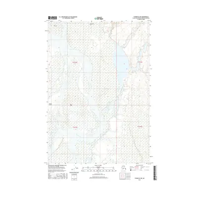
2016 Map of Tyonek B-2 NE
USGS Topo · Published 2016About this map
The Susitna River dominates this Alaskan landscape, carving a wide, braided path through the wetlands and riverine lowlands of the Matanuska-Susitna Borough. This 2016 survey highlights several areas of cultural and geographic significance, including the labeled locations of Shaqach’egh Kena, Qaitsusi, and Dehgega Inejaht. These names reflect the enduring indigenous footprint on the land, particularly around the many-channeled water systems that define the region.
Find a feature on this map
15 named features on this map. Tap any name to fly to it.
Don’t see what you’re looking for? This feature index may not catch every label — zoom into the map to look around manually.
Map Details
Editions of this 2016 Tyonek B-2 NE Map
This is the sole edition of this map. No revisions or reprints were ever made.
Other maps of this area

1949 · Tyonek
USGS Topo · 1:250,000

1951 · Tyonek
USGS Topo · 1:250,000

1952 · Tyonek C-1
USGS Topo · 1:63,360

1958 · Tyonek C-2
USGS Topo · 1:63,360

1958 · Tyonek B-1
USGS Topo · 1:63,360

1958 · Tyonek B-2
USGS Topo · 1:63,360

1958 · Tyonek C-1
USGS Topo · 1:63,360

1958 · Tyonek
USGS Topo · 1:250,000

1965 · Tyonek
USGS Topo · 1:250,000
1993 · Tyonek C-1
USGS Topo · 1:63,360