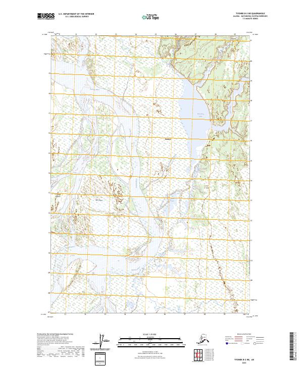
2023 Map of Tyonek B-2 NE
USGS Topo · Published 2023About this map
The braided channels of the Susitna River dominate this landscape, illustrating the shifting hydrology and sediment patterns of south-central Alaska. At the heart of this aquatic network lies Susitna, a location situated amidst a complex of wetlands and low-lying terrain. The map records a dense collection of water bodies, including the sizeable Flat Horn Lake and smaller features like Maid Lake, which feed into the secondary drainage of Alexander Creek and Fish Creek.
Find a feature on this map
12 named features on this map. Tap any name to fly to it.
Don’t see what you’re looking for? This feature index may not catch every label — zoom into the map to look around manually.
Map Details
Editions of this 2023 Tyonek B-2 NE Map
This is the sole edition of this map. No revisions or reprints were ever made.
Other maps of this area

1949 · Tyonek
USGS Topo · 1:250,000

1951 · Tyonek
USGS Topo · 1:250,000

1952 · Tyonek C-1
USGS Topo · 1:63,360

1958 · Tyonek C-2
USGS Topo · 1:63,360

1958 · Tyonek B-1
USGS Topo · 1:63,360

1958 · Tyonek B-2
USGS Topo · 1:63,360

1958 · Tyonek C-1
USGS Topo · 1:63,360

1958 · Tyonek
USGS Topo · 1:250,000

1965 · Tyonek
USGS Topo · 1:250,000
1993 · Tyonek C-1
USGS Topo · 1:63,360