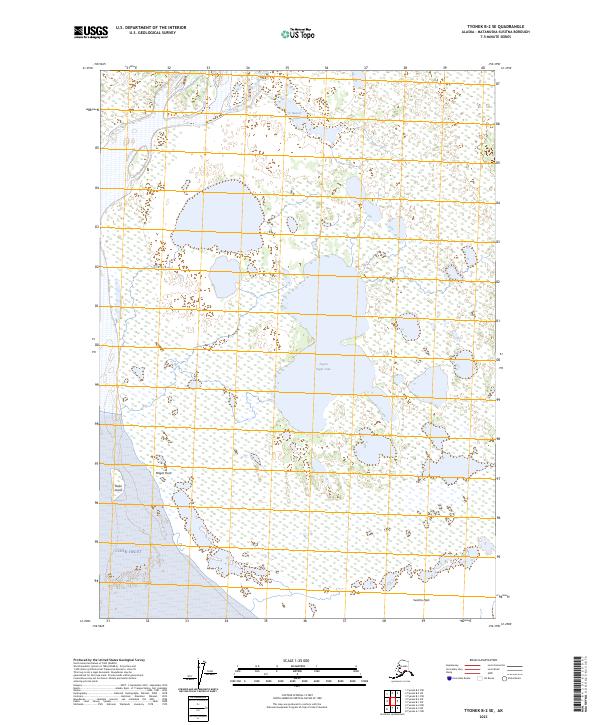
2023 Map of Tyonek B-2 SE
USGS Topo · Published 2023About this map
Figure Eight Lake and Beaver Lake dominate this coastal landscape on the edge of the Cook Inlet, where the intricate hydrology of the Susitna Flats meets the sea. The map documents a complex mosaic of wetlands and small ponds, illustrating the low-lying terrain north of the inlet. Key landforms such as Magot Point and Delta Island define the shifting shoreline where Fish Creek drains into the larger basin. This recent survey reflects the environmental character of the Matanuska-Susitna region, where the intersection of freshwater systems and tidal flats creates a dynamic wetland environment largely devoid of formal road infrastructure, emphasizing the area's reliance on natural waterways.
Find a feature on this map
13 named features on this map. Tap any name to fly to it.
Don’t see what you’re looking for? This feature index may not catch every label — zoom into the map to look around manually.
Map Details
Editions of this 2023 Tyonek B-2 SE Map
This is the sole edition of this map. No revisions or reprints were ever made.
Other maps of this area

1949 · Tyonek
USGS Topo · 1:250,000

1951 · Tyonek
USGS Topo · 1:250,000

1951 · Tyonek A-2
USGS Topo · 1:63,360

1951 · Tyonek A-1
USGS Topo · 1:63,360

1952 · Tyonek A-2
USGS Topo · 1:63,360

1952 · Tyonek A-1
USGS Topo · 1:63,360

1958 · Tyonek B-1
USGS Topo · 1:63,360

1958 · Tyonek B-2
USGS Topo · 1:63,360

1958 · Tyonek
USGS Topo · 1:250,000

1965 · Tyonek
USGS Topo · 1:250,000