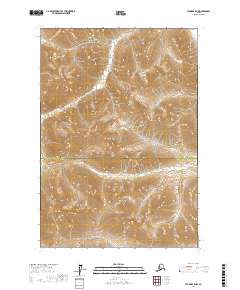
2017 Map of Tyonek B-8 NW
USGS Topo · Published 2017About this map
Lake Clark National Park encompasses a significant portion of this high-elevation wilderness, where steep slopes and alpine ridges dominate the landscape. The terrain is defined by extreme relief and complex drainage patterns, with contours rising sharply through the protected park lands. The boundary between Matanuska-Susitna Borough and Kenai Peninsula Borough bisects the region, marking a jurisdictional line through a remote and uninhabited expanse of the Alaskan interior. This 2017 survey by the U.S. Geological Survey illustrates the intersection of these major administrative districts within a landscape characterized by deep valleys and high mountain passes, offering a detailed topographical view of a region defined more by its natural boundaries and federal protections than by human settlement.
Find a feature on this map
6 named features on this map. Tap any name to fly to it.
Don’t see what you’re looking for? This feature index may not catch every label — zoom into the map to look around manually.
Map Details
Editions of this 2017 Tyonek B-8 NW Map
This is the sole edition of this map. No revisions or reprints were ever made.
Other maps of this area

1949 · Tyonek
USGS Topo · 1:250,000

1951 · Tyonek
USGS Topo · 1:250,000

1951 · Lime Hills
USGS Topo · 1:250,000

1958 · Tyonek B-8
USGS Topo · 1:63,360

1958 · Tyonek C-8
USGS Topo · 1:63,360

1958 · Tyonek
USGS Topo · 1:250,000

1958 · Lime Hills B-1
USGS Topo · 1:63,360

1958 · Lime Hills C-1
USGS Topo · 1:63,360

1958 · Lime Hills
USGS Topo · 1:250,000

1965 · Tyonek
USGS Topo · 1:250,000