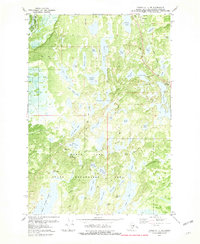
1979 Map of Tyonek C-1 NE
USGS Topo · Published 1981About this map
Willow serves as a primary point of reference in this landscape dominated by a vast network of water bodies and recreational lands. The northeastern corner is anchored by the Alaska Railroad and the community center, while the expansive Nancy Lake State Recreation Area preserves a dense concentration of interior lakes. The terrain is marked by distinct features such as Radar Hill and a variety of navigable water bodies including Nancy Lake, Willow Lake, and Long Lake.
Find a feature on this map
58 named features on this map. Tap any name to fly to it.
Don’t see what you’re looking for? This feature index may not catch every label — zoom into the map to look around manually.
Map Details
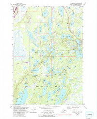
Editions of this 1979 Tyonek C-1 NE Map
2 editions found
Other maps of this area

1949 · Tyonek
USGS Topo · 1:250,000

1949 · Anchorage D-8
USGS Topo · 1:63,360

1950 · Anchorage C-8
USGS Topo · 1:63,360

1951 · Anchorage
USGS Topo · 1:250,000

1951 · Tyonek
USGS Topo · 1:250,000

1951 · Anchorage D-8
USGS Topo · 1:63,360

1952 · Anchorage C-8
USGS Topo · 1:63,360

1952 · Tyonek D-1
USGS Topo · 1:63,360

1952 · Tyonek C-1
USGS Topo · 1:63,360

1952 · Anchorage D-8
USGS Topo · 1:63,360