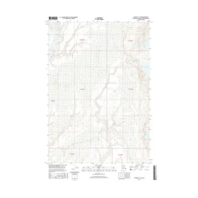
2016 Map of Tyonek C-1 SW
USGS Topo · Published 2016About this map
The Susitna River dominates this landscape in the Matanuska-Susitna Borough, its expansive braided channel cutting through a low-lying basin. The settlement of Susitna sits on the eastern bank, positioned at a historically significant location for river navigation and regional access. East of the river, the terrain is characterized by a dense network of wetlands and lakes, including the large Red Shirt Lake and smaller bodies like Cow Lake and Hock Lake. The intricate hydrography of Fish Cr and numerous unnamed ponds highlights a complex aqueous environment that has long dictated movement and settlement patterns in this part of Alaska. This survey provides a clear look at the township and range lines across the Susitna Valley as they stood in the mid-2010s.
Find a feature on this map
12 named features on this map. Tap any name to fly to it.
Don’t see what you’re looking for? This feature index may not catch every label — zoom into the map to look around manually.
Map Details
Editions of this 2016 Tyonek C-1 SW Map
This is the sole edition of this map. No revisions or reprints were ever made.
Other maps of this area

1949 · Tyonek
USGS Topo · 1:250,000

1951 · Tyonek
USGS Topo · 1:250,000

1952 · Tyonek C-1
USGS Topo · 1:63,360

1958 · Tyonek C-2
USGS Topo · 1:63,360

1958 · Tyonek B-1
USGS Topo · 1:63,360

1958 · Tyonek B-2
USGS Topo · 1:63,360

1958 · Tyonek C-1
USGS Topo · 1:63,360

1958 · Tyonek
USGS Topo · 1:250,000

1965 · Tyonek
USGS Topo · 1:250,000
1979 · Tyonek B-1 NE
USGS Topo · 1:25,000