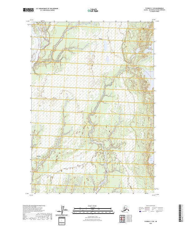
2023 Map of Tyonek C-1 SW
USGS Topo · Published 2023About this map
Willow and Susitna anchor the northwestern and southwestern reaches of this survey, which documents the complex wetland and riverine landscape within the Matanuska-Susitna Borough. The mighty Susitna River cuts across the western edge of the quadrangle, serving as a primary geographical marker for this part of Alaska. Moving east, the terrain transitions into a dense network of marshes and water bodies, including Fish Creek and several lakes with names reflecting the region's indigenous heritage, such as Beq'estsiq' Tuyu'uh and T'leghes Bena Q'estsiq'.
Find a feature on this map
14 named features on this map. Tap any name to fly to it.
Don’t see what you’re looking for? This feature index may not catch every label — zoom into the map to look around manually.
Map Details
Editions of this 2023 Tyonek C-1 SW Map
This is the sole edition of this map. No revisions or reprints were ever made.
Other maps of this area

1949 · Tyonek
USGS Topo · 1:250,000

1951 · Tyonek
USGS Topo · 1:250,000

1952 · Tyonek C-1
USGS Topo · 1:63,360

1958 · Tyonek C-2
USGS Topo · 1:63,360

1958 · Tyonek B-1
USGS Topo · 1:63,360

1958 · Tyonek B-2
USGS Topo · 1:63,360

1958 · Tyonek C-1
USGS Topo · 1:63,360

1958 · Tyonek
USGS Topo · 1:250,000

1965 · Tyonek
USGS Topo · 1:250,000
1979 · Tyonek B-1 NE
USGS Topo · 1:25,000