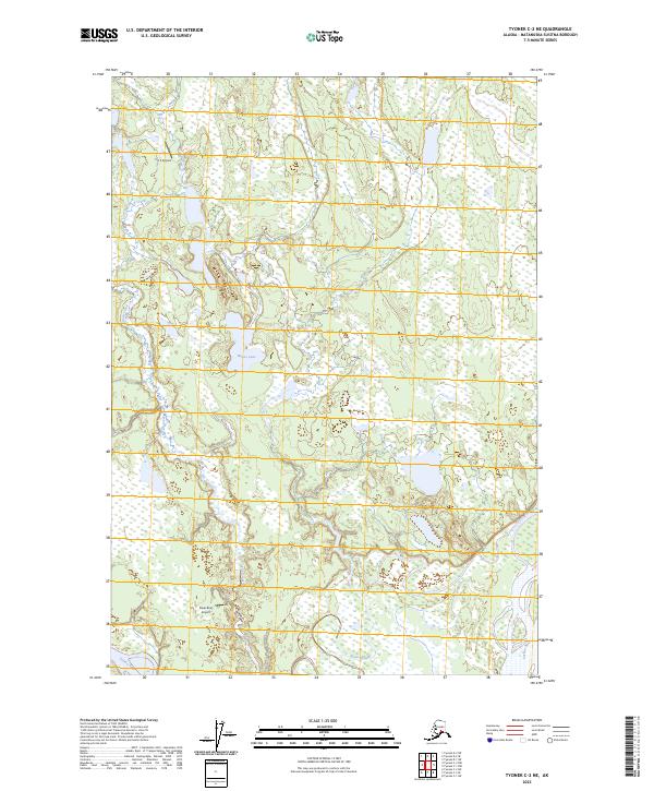
2023 Map of Tyonek C-2 NE
USGS Topo · Published 2023About this map
The Susitna River and the Yentna River meet in a landscape of complex waterways and wetlands in this portion of the Matanuska-Susitna Borough. This 2023 survey illustrates the dynamic hydrology of the region, where the broad Kroto Slough meanders through the lowland terrain. The presence of remote aviation infrastructure, such as the Poker Bluff Airport and CTS Airport, highlights the essential role of air travel in navigating this roadless Alaskan interior. Isolated water bodies like Witsoe Lake and the winding course of Fish Creek further characterize the area's intricate drainage patterns, providing a detailed look at the environment just upstream from the Cook Inlet confluence.
Find a feature on this map
11 named features on this map. Tap any name to fly to it.
Don’t see what you’re looking for? This feature index may not catch every label — zoom into the map to look around manually.
Map Details
Editions of this 2023 Tyonek C-2 NE Map
This is the sole edition of this map. No revisions or reprints were ever made.
Other maps of this area

1949 · Tyonek
USGS Topo · 1:250,000

1951 · Tyonek
USGS Topo · 1:250,000

1952 · Tyonek D-1
USGS Topo · 1:63,360

1952 · Tyonek C-1
USGS Topo · 1:63,360

1954 · Tyonek D-2
USGS Topo · 1:63,360

1954 · Tyonek D-1
USGS Topo · 1:63,360

1958 · Tyonek C-2
USGS Topo · 1:63,360

1958 · Tyonek C-1
USGS Topo · 1:63,360

1958 · Tyonek
USGS Topo · 1:250,000

1965 · Tyonek
USGS Topo · 1:250,000