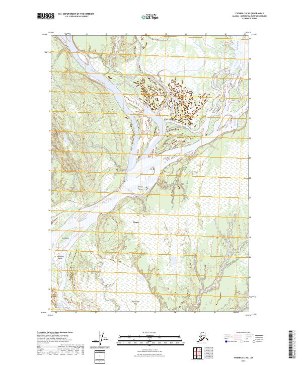
2023 Map of Tyonek C-2 SE
USGS Topo · Published 2023About this map
The Susitna River and Yentna River converge in this wetland-heavy landscape of the Susitna Valley. This modern survey documents the intricate network of water and terrain names that characterize the region, including the settlement of Susitna. The area is defined by complex hydrological features such as Kroto Slough and Leech Lake, interspersed with traditional Dena'ina place names. Significant landforms like Beq'e Tach'itqeyi, Qanigi Te'iht, and Yusdishlaq' are clearly delineated, reflecting the indigenous geography of the Matanuska-Susitna Borough. The concentration of sloughs, creeks like Fish Creek, and flats such as Shaq'ach'egh Kena illustrates a shifting riverine environment where land and water frequently overlap.
Find a feature on this map
20 named features on this map. Tap any name to fly to it.
Don’t see what you’re looking for? This feature index may not catch every label — zoom into the map to look around manually.
Map Details
Editions of this 2023 Tyonek C-2 SE Map
This is the sole edition of this map. No revisions or reprints were ever made.
Other maps of this area

1949 · Tyonek
USGS Topo · 1:250,000

1951 · Tyonek
USGS Topo · 1:250,000

1952 · Tyonek C-1
USGS Topo · 1:63,360

1958 · Tyonek C-2
USGS Topo · 1:63,360

1958 · Tyonek B-1
USGS Topo · 1:63,360

1958 · Tyonek B-2
USGS Topo · 1:63,360

1958 · Tyonek C-1
USGS Topo · 1:63,360

1958 · Tyonek
USGS Topo · 1:250,000

1965 · Tyonek
USGS Topo · 1:250,000
1993 · Tyonek C-1
USGS Topo · 1:63,360