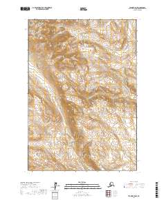
2017 Map of Tyonek C-5 NW
USGS Topo · Published 2017About this map
Talachulitna Cr flows through the southeastern corner of this region, serving as a primary drainage for the complex network of mountain streams that define the local topography. This 2017 survey shows an entirely uninhabited landscape within the t19n r14w and t18n r14w townships, where the terrain is shaped by the parallel paths of Friday Cr, Saturday Cr, and Coal Cr. The lack of man-made infrastructure, roads, or structures highlights the remote wilderness character of this portion of the Matanuska-Susitna Borough. The drainage patterns and contour intervals indicate high-altitude headwaters that feed eventually into the larger Talachulitna River system, making this a critical reference for understanding the hydrology of this roadless interior region.
Find a feature on this map
8 named features on this map. Tap any name to fly to it.
Don’t see what you’re looking for? This feature index may not catch every label — zoom into the map to look around manually.
Map Details
Editions of this 2017 Tyonek C-5 NW Map
This is the sole edition of this map. No revisions or reprints were ever made.
Other maps of this area

1949 · Tyonek
USGS Topo · 1:250,000

1951 · Tyonek
USGS Topo · 1:250,000

1954 · Tyonek C-5
USGS Topo · 1:63,360

1954 · Tyonek D-5
USGS Topo · 1:63,360

1958 · Tyonek C-6
USGS Topo · 1:63,360

1958 · Tyonek D-6
USGS Topo · 1:63,360

1958 · Tyonek
USGS Topo · 1:250,000

1965 · Tyonek
USGS Topo · 1:250,000
2016 · Tyonek C-5 SE
USGS Topo · 1:25,000
2016 · Tyonek C-5 NE
USGS Topo · 1:25,000