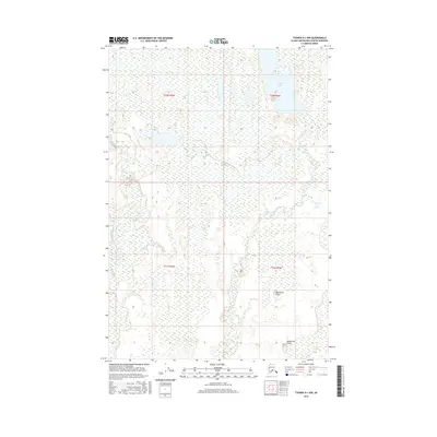
2016 Map of Tyonek D-1 NW
USGS Topo · Published 2016About this map
Trapper Lake and the surrounding wetland complex define this landscape in the Matanuska-Susitna Borough, revealing the intricate water patterns of south-central Alaska. The Deshka River flows along the western edge of the quadrangle, while Trapper Creek moves through the central and southern sections, creating a network of drainage basins. The presence of the Kashwitna Knobs provides a distinct break in the low-lying terrain, offering topographical relief among the numerous unnamed ponds and marshes characteristic of the region. This 2016 survey highlights the complex hydrography of the area, illustrating how the glacial legacy has shaped the modern Alaskian wilderness.
Find a feature on this map
8 named features on this map. Tap any name to fly to it.
Don’t see what you’re looking for? This feature index may not catch every label — zoom into the map to look around manually.
Map Details
Editions of this 2016 Tyonek D-1 NW Map
This is the sole edition of this map. No revisions or reprints were ever made.
Other maps of this area

1949 · Tyonek
USGS Topo · 1:250,000

1950 · Talkeetna
USGS Topo · 1:250,000

1951 · Talkeetna
USGS Topo · 1:250,000

1951 · Tyonek
USGS Topo · 1:250,000

1952 · Tyonek D-1
USGS Topo · 1:63,360

1952 · Talkeetna A-1
USGS Topo · 1:63,360

1954 · Tyonek D-2
USGS Topo · 1:63,360

1954 · Tyonek D-1
USGS Topo · 1:63,360
1958 · Talkeetna A-1
USGS Topo · 1:63,360

1958 · Tyonek
USGS Topo · 1:250,000