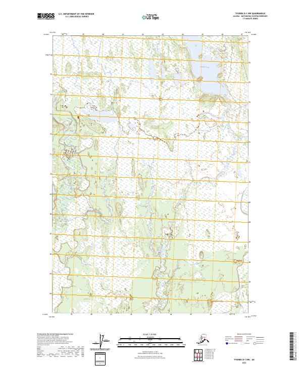
2023 Map of Tyonek D-1 NW
USGS Topo · Published 2023About this map
Trapper Lake and the winding course of the Deshka River anchor this Alaskan landscape within the Matanuska-Susitna Borough. This high-resolution 2023 survey documents a complex network of wetlands and seasonal waterways, including the drainage of Trapper Creek as it flows south toward the Susitna Valley. The terrain is characterized by the Kashwitna Knobs in the southeastern corner, providing a rare point of elevation in an otherwise low-lying, water-saturated basin. This map serves as a vital record of the modern hydrography in a region where the shifting channels of the Deshka River define the local topography and access. The absence of developed roads or settlements on this sheet highlights the primitive state of the wilderness in this part of the Tyonek D-1 NW quadrangle.
Find a feature on this map
8 named features on this map. Tap any name to fly to it.
Don’t see what you’re looking for? This feature index may not catch every label — zoom into the map to look around manually.
Map Details
Editions of this 2023 Tyonek D-1 NW Map
This is the sole edition of this map. No revisions or reprints were ever made.
Other maps of this area

1949 · Tyonek
USGS Topo · 1:250,000

1950 · Talkeetna
USGS Topo · 1:250,000

1951 · Talkeetna
USGS Topo · 1:250,000

1951 · Tyonek
USGS Topo · 1:250,000

1952 · Tyonek D-1
USGS Topo · 1:63,360

1952 · Talkeetna A-1
USGS Topo · 1:63,360

1954 · Tyonek D-2
USGS Topo · 1:63,360

1954 · Tyonek D-1
USGS Topo · 1:63,360
1958 · Talkeetna A-1
USGS Topo · 1:63,360

1958 · Tyonek
USGS Topo · 1:250,000