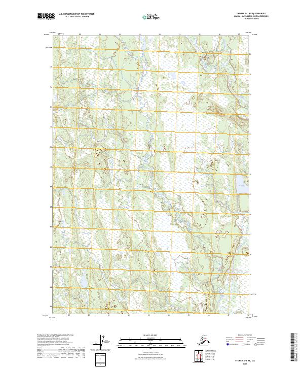
2023 Map of Tyonek D-2 NE
USGS Topo · Published 2023About this map
The Deshka River dominates this interior Alaskan corridor in the Matanuska-Susitna Borough, where it winds through a landscape defined by extensive wetlands and meandering tributaries. The map documents a sparsely settled region where hydrological patterns shape the land, characterized by the convergence of Moose Creek and Chijuk Creek as they feed into the larger river system. Toward the eastern boundary, Neil Lake provides a significant landmark amidst the surrounding marshes. This 2023 edition uses data from the U.S. Geological Survey to delineate township and range boundaries including t22n r7w and t21n r6w, offering a clear view of the public land survey system in this part of the Susitna Valley. The absence of roads or permanent structures reflects the remote character of this riverine environment.
Find a feature on this map
8 named features on this map. Tap any name to fly to it.
Don’t see what you’re looking for? This feature index may not catch every label — zoom into the map to look around manually.
Map Details
Editions of this 2023 Tyonek D-2 NE Map
This is the sole edition of this map. No revisions or reprints were ever made.
Other maps of this area

1949 · Tyonek
USGS Topo · 1:250,000

1950 · Talkeetna
USGS Topo · 1:250,000

1951 · Talkeetna
USGS Topo · 1:250,000

1951 · Tyonek
USGS Topo · 1:250,000

1952 · Tyonek D-1
USGS Topo · 1:63,360

1952 · Talkeetna A-1
USGS Topo · 1:63,360

1954 · Tyonek D-2
USGS Topo · 1:63,360

1954 · Tyonek D-1
USGS Topo · 1:63,360

1954 · Talkeetna A-2
USGS Topo · 1:63,360
1958 · Talkeetna A-1
USGS Topo · 1:63,360