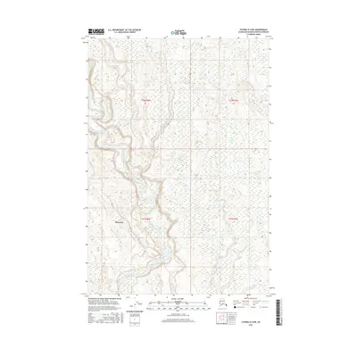
2016 Map of Tyonek D-2 NW
USGS Topo · Published 2016About this map
Skwentna sits at the western edge of this survey, where the low-lying wetlands of the Matanuska-Susitna region meet a complex network of glacial meltwater. The Kahiltna River dominates the landscape, its braided channels and wide gravel bars carving a shifting path through the glacial outwash. This drainage system is further defined by the smaller tributaries of Fish Cr and Moose Cr, which navigate a dense mosaic of muskeg and small lakes typical of the South Central Alaskan interior. The layout of the township and range lines, such as t22n r8w and t21n r8w, underscores the vastness of this roadless area where the river serves as the primary corridor for navigation and survival.
Find a feature on this map
8 named features on this map. Tap any name to fly to it.
Don’t see what you’re looking for? This feature index may not catch every label — zoom into the map to look around manually.
Map Details
Editions of this 2016 Tyonek D-2 NW Map
This is the sole edition of this map. No revisions or reprints were ever made.
Other maps of this area

1949 · Tyonek
USGS Topo · 1:250,000

1950 · Talkeetna
USGS Topo · 1:250,000

1951 · Talkeetna
USGS Topo · 1:250,000

1951 · Tyonek
USGS Topo · 1:250,000

1954 · Tyonek D-2
USGS Topo · 1:63,360

1954 · Tyonek D-3
USGS Topo · 1:63,360

1954 · Talkeetna A-2
USGS Topo · 1:63,360

1958 · Tyonek
USGS Topo · 1:250,000

1958 · Talkeetna
USGS Topo · 1:250,000

1965 · Tyonek
USGS Topo · 1:250,000