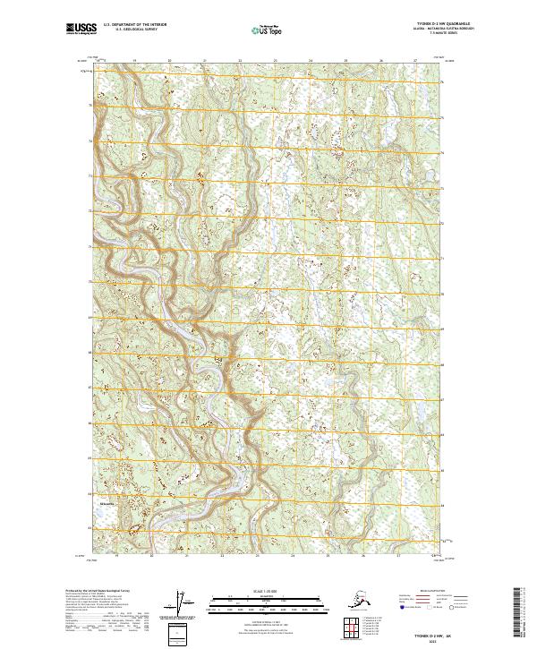
2023 Map of Tyonek D-2 NW
USGS Topo · Published 2023About this map
Skwentna sits at the southwestern edge of this survey, marking a vital point of contact in a landscape defined by its braided glacial waterways. The Kahiltna River dominates the western half of the terrain, weaving a complex network of channels and sandbars as it flows southward. Further east, the meandering paths of Moose Creek and Fish Creek cut through the marshy lowlands, illustrating the intricate drainage patterns of the Matanuska-Susitna region. These river systems serve as the primary geographical landmarks in a territory largely defined by its wetland composition and township divisions, including t22n r8w and t21n r7w. The detailed mapping of these hydrographic features provides a clear view of the natural corridors used for navigation and subsistence in this part of Alaska.
Find a feature on this map
8 named features on this map. Tap any name to fly to it.
Don’t see what you’re looking for? This feature index may not catch every label — zoom into the map to look around manually.
Map Details
Editions of this 2023 Tyonek D-2 NW Map
This is the sole edition of this map. No revisions or reprints were ever made.
Other maps of this area

1949 · Tyonek
USGS Topo · 1:250,000

1950 · Talkeetna
USGS Topo · 1:250,000

1951 · Talkeetna
USGS Topo · 1:250,000

1951 · Tyonek
USGS Topo · 1:250,000

1954 · Tyonek D-2
USGS Topo · 1:63,360

1954 · Tyonek D-3
USGS Topo · 1:63,360

1954 · Talkeetna A-2
USGS Topo · 1:63,360

1958 · Tyonek
USGS Topo · 1:250,000

1958 · Talkeetna
USGS Topo · 1:250,000

1965 · Tyonek
USGS Topo · 1:250,000