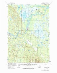
1954 Map of Tyonek D-4
USGS Topo · Published 1972About this map
Skwentna sits at the confluence of the Yentna River and the Skwentna River, serving as a vital aviation and river hub in the Matanuska-Susitna region during the mid-1950s. The presence of the Skwentna Airport, complete with a Radio Range Sta, Antennas, and a Beacon, underscores the community's importance to territorial air travel. To the southwest, the Old Skwentna Road House (Site) marks an earlier era of overland transport along the Winter Trail. The landscape is defined by vast wetland systems and numerous lakes, such as the curiously named Whiskey Lake and Bourbon Mist Island. To the west, the Shell Hills rise above the drainage of Shell Creek, while the southern reaches are dominated by the winding course of the Talachulitna River. This survey reveals a landscape where traditional trail networks and modern aviation infrastructure coexisted to bridge the Alaskan wilderness.
Find a feature on this map
31 named features on this map. Tap any name to fly to it.
Don’t see what you’re looking for? This feature index may not catch every label — zoom into the map to look around manually.
Map Details
Editions of this 1954 Tyonek D-4 Map
2 editions found
Other maps of this area

1949 · Tyonek
USGS Topo · 1:250,000

1950 · Talkeetna
USGS Topo · 1:250,000

1951 · Talkeetna
USGS Topo · 1:250,000

1951 · Tyonek
USGS Topo · 1:250,000

1954 · Tyonek D-3
USGS Topo · 1:63,360

1954 · Talkeetna A-3
USGS Topo · 1:63,360

1954 · Tyonek C-5
USGS Topo · 1:63,360

1954 · Tyonek C-4
USGS Topo · 1:63,360

1954 · Tyonek D-5
USGS Topo · 1:63,360

1954 · Tyonek D-4
USGS Topo · 1:63,360