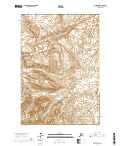
2017 Map of Tyonek D-5 SW
USGS Topo · Published 2017About this map
Canyon Creek and Contact Creek define the drainage patterns of this Alaskan landscape within the Matanuska-Susitna Borough. This 2017 survey illustrates a high-elevation wilderness where steep contour lines reveal sharp ridges and deep valleys. The map is primarily organized by the Public Land Survey System, showing segments of townships including t20n r14w, t21n r14w, and t19n r14w. This specific quadrangle captures a remote section of the state where natural watercourses like Contact Creek dictate the topography, offering a clear record of the terrain as it existed in the early 21st century before any significant infrastructure or road development reached these coordinates.
Find a feature on this map
8 named features on this map. Tap any name to fly to it.
Don’t see what you’re looking for? This feature index may not catch every label — zoom into the map to look around manually.
Map Details
Editions of this 2017 Tyonek D-5 SW Map
This is the sole edition of this map. No revisions or reprints were ever made.
Other maps of this area

1949 · Tyonek
USGS Topo · 1:250,000

1951 · Tyonek
USGS Topo · 1:250,000

1954 · Tyonek C-5
USGS Topo · 1:63,360

1954 · Tyonek D-5
USGS Topo · 1:63,360

1958 · Tyonek C-6
USGS Topo · 1:63,360

1958 · Tyonek D-6
USGS Topo · 1:63,360

1958 · Tyonek
USGS Topo · 1:250,000

1965 · Tyonek
USGS Topo · 1:250,000
2016 · Tyonek C-5 NE
USGS Topo · 1:25,000
2016 · Tyonek D-5 SE
USGS Topo · 1:25,000