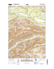
2016 Map of Tyonek D-7 NE
USGS Topo · Published 2016About this map
The Skwentna River serves as the central drainage for this section of the Matanuska-Susitna Borough, where it is joined by the Chickak River and fed by the Happy River from the north. The landscape is defined by the sharp transition between the glacial river valleys and the rising elevations toward the south, where Old Man Creek winds through steepening contours. In the northwest, Shirley Lake sits on a high bench above the river systems. This survey documents the complex braided watercourses of the Alaska interior, highlighting the dynamic nature of these glacial rivers before they merge into larger downstream networks.
Find a feature on this map
10 named features on this map. Tap any name to fly to it.
Don’t see what you’re looking for? This feature index may not catch every label — zoom into the map to look around manually.
Map Details
Editions of this 2016 Tyonek D-7 NE Map
This is the sole edition of this map. No revisions or reprints were ever made.
Other maps of this area

1949 · Tyonek
USGS Topo · 1:250,000

1950 · Talkeetna
USGS Topo · 1:250,000

1951 · Talkeetna
USGS Topo · 1:250,000

1951 · Tyonek
USGS Topo · 1:250,000

1958 · Tyonek D-6
USGS Topo · 1:63,360

1958 · Talkeetna A-5
USGS Topo · 1:63,360

1958 · Tyonek
USGS Topo · 1:250,000

1958 · Talkeetna
USGS Topo · 1:250,000
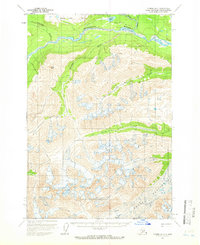
1958 · Tyonek D-7
USGS Topo · 1:63,360

1965 · Tyonek
USGS Topo · 1:250,000