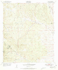
1951 Map of Tyrone
USGS Topo · Published 1955About this map
The Continental Divide winds through the high desert of Grant County, marking the transition between the Burro Mountains and the surrounding arroyos. During the early 1950s, the mining settlement of Tyrone serves as a focal point for the region's industrial activity, though USGS notes at the time indicate that all mines on this sheet were inactive. The map provides a detailed view of the extraction infrastructure that shaped this landscape, from the Niagara Tunnel and No. 3 Shaft to the specifically named Copper Golf Shaft and Gettysburg Shaft. Water management in this arid environment is clearly documented through a network of windmills and tanks, including the Colored Windmill and the Water Tanks near Oak Grove. Transportation is defined by the Atchison Topeka and Santa Fe railroad corridor in the northeast and the path of Route 180, while local topography is etched with seasonal drainages like Graveyard Draw and San Vicente Arroyo.
Find a feature on this map
28 named features on this map. Tap any name to fly to it.
Don’t see what you’re looking for? This feature index may not catch every label — zoom into the map to look around manually.
Map Details
Editions of this 1951 Tyrone Map
2 editions found
Other maps of this area

1909 · Silver City
USGS Topo · 1:125,000

1947 · Fort Bayard
USGS Topo · 1:24,000

1949 · Fort Bayard
USGS Topo · 1:24,000

1949 · Whitewater
USGS Topo · 1:24,000

1949 · Hurley West
USGS Topo · 1:24,000

1949 · Circle Mesa
USGS Topo · 1:24,000

1950 · Tyrone
USGS Topo · 1:24,000

1950 · White Signal
USGS Topo · 1:24,000

1950 · Wind Mountain
USGS Topo · 1:24,000

1950 · Burro Peak
USGS Topo · 1:24,000