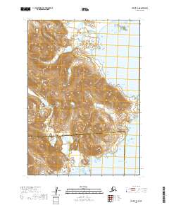
2019 Map of Ugashik A-2 NE
USGS Topo · Published 2019About this map
The Aleutian Range dominates this coastal landscape along the southern edge of the Alaska Peninsula, where steep topographic gradients drop directly into the Pacific Ocean. This 2019 survey captures a remote wilderness environment defined by glacial runoff and coastal indentations, most notably where Glacier Creek and Kilukak Cr drain the high peaks toward the shore. The boundary between the Kodiak Island Borough and Lake and Peninsula Borough bisects the terrain, marking a jurisdictional divide in an area otherwise characterized by its physical isolation.
Find a feature on this map
12 named features on this map. Tap any name to fly to it.
Don’t see what you’re looking for? This feature index may not catch every label — zoom into the map to look around manually.
Map Details
Editions of this 2019 Ugashik A-2 NE Map
This is the sole edition of this map. No revisions or reprints were ever made.
Other maps of this area

1943 · Ugashik
USGS Topo · 1:250,000

1948 · Ugashik
USGS Topo · 1:250,000

1949 · Ugashik
USGS Topo · 1:250,000

1951 · Ugashik B-1
USGS Topo · 1:63,360

1951 · Ugashik A-2
USGS Topo · 1:63,360

1951 · Ugashik B-2
USGS Topo · 1:63,360

1963 · Ugashik
USGS Topo · 1:250,000
2019 · Ugashik B-2 SW
USGS Topo · 1:25,000
2019 · Ugashik A-2 NW
USGS Topo · 1:25,000
2019 · Ugashik B-2 SE
USGS Topo · 1:25,000