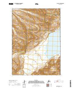
2019 Map of Ugashik B-2 SW
USGS Topo · Published 2019About this map
Aleutian Range peaks dominate this coastal portion of the Alaska Peninsula, where steep topography meets the northern reaches of the Pacific Ocean. The landscape is defined by dramatic elevation changes, centered around the volcanic profile of Mt Alai and the isolated prominence of Lone Hill to the southwest. This 2019 survey documents a wilderness area split by the administrative boundary of the Lake and Peninsula Borough and Kodiak Island Borough. The drainage of Kialagvik Creek provides a focal point for the interior lowlands, carving a path through the townships toward the coastline. This map is a primary resource for understanding the contemporary geomorphology of this remote maritime frontier, showing the intersection of glacial-carved mountains and the sea.
Find a feature on this map
12 named features on this map. Tap any name to fly to it.
Don’t see what you’re looking for? This feature index may not catch every label — zoom into the map to look around manually.
Map Details
Editions of this 2019 Ugashik B-2 SW Map
This is the sole edition of this map. No revisions or reprints were ever made.
Other maps of this area

1943 · Ugashik
USGS Topo · 1:250,000

1948 · Ugashik
USGS Topo · 1:250,000

1949 · Ugashik
USGS Topo · 1:250,000

1951 · Ugashik B-3
USGS Topo · 1:63,360

1951 · Ugashik A-2
USGS Topo · 1:63,360

1951 · Ugashik B-2
USGS Topo · 1:63,360

1954 · Ugashik A-3
USGS Topo · 1:63,360

1963 · Ugashik
USGS Topo · 1:250,000
2019 · Ugashik A-2 NE
USGS Topo · 1:25,000
2019 · Ugashik A-3 NE
USGS Topo · 1:25,000