
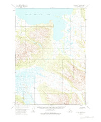
1951 Map of Ugashik B-3
USGS Topo · Published 1956About this map
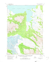
Lower Ugashik Lake dominates the northern reaches of this mid-century survey, its expansive waters meeting a shoreline of intricate inlets and wetlands. The drainage patterns of the Alaska Peninsula are clearly delineated, showing the flow of the Dog Salmon River as it winds through the south-central landscape, fed by tributaries like Goblet Creek and the long, winding Figure Eight Creek. High elevations are concentrated in the central-western portion of the quadrangle, where steep contours rise above small glacial basins containing Elizabeth Lake and Lenora Lake. This 1951 documentation, based on aerial photography from that same year, captures the region's hydrography and topography before significant modern changes, showcasing a wilderness defined by water and high ridges. The map is particularly useful for understanding the primary watercourses and seasonal drainage routes, such as Black Creek, which are critical to the local ecosystem and historical transit.
Find a feature on this map
7 named features on this map. Tap any name to fly to it.
Don’t see what you’re looking for? This feature index may not catch every label — zoom into the map to look around manually.
Map Details
Editions of this 1951 Ugashik B-3 Map
3 editions found
Other maps of this area

1943 · Ugashik
USGS Topo · 1:250,000

1948 · Ugashik
USGS Topo · 1:250,000

1949 · Ugashik
USGS Topo · 1:250,000

1951 · Ugashik C-4
USGS Topo · 1:63,360

1951 · Ugashik C-2
USGS Topo · 1:63,360

1951 · Ugashik C-3
USGS Topo · 1:63,360

1951 · Ugashik A-2
USGS Topo · 1:63,360

1951 · Ugashik B-2
USGS Topo · 1:63,360

1954 · Ugashik A-3
USGS Topo · 1:63,360

1954 · Ugashik B-4
USGS Topo · 1:63,360