
1951 Map of Ugashik C-3
USGS Topo · Published 1956About this map
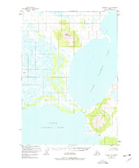
Upper Ugashik Lake dominates this mid-century Alaskan landscape, providing a clear look at the intricate shoreline and drainage patterns of the Alaska Peninsula before significant modern development. The map shows the narrow land bridge separating the upper waters from Lower Ugashik Lake, a critical point for local navigation and movement. A solitary Cabin is marked along the southeastern shore of the upper lake, representing the sparse human footprint in this wilderness during the early 1950s. Surveyors identified key topographic benchmarks such as Vabm 1776 (Hill) and the distinctive Vabm 344 (Cone), which served as essential navigational and mapping points in a region characterized by its expansive water bodies and varied elevations.
Find a feature on this map
5 named features on this map. Tap any name to fly to it.
Don’t see what you’re looking for? This feature index may not catch every label — zoom into the map to look around manually.
Map Details
Editions of this 1951 Ugashik C-3 Map
2 editions found
Other maps of this area

1943 · Ugashik
USGS Topo · 1:250,000

1948 · Ugashik
USGS Topo · 1:250,000

1949 · Ugashik
USGS Topo · 1:250,000

1951 · Ugashik C-4
USGS Topo · 1:63,360

1951 · Ugashik B-3
USGS Topo · 1:63,360

1951 · Ugashik C-2
USGS Topo · 1:63,360

1951 · Ugashik D-3
USGS Topo · 1:63,360

1951 · Ugashik D-4
USGS Topo · 1:63,360

1951 · Ugashik D-2
USGS Topo · 1:63,360

1951 · Ugashik B-2
USGS Topo · 1:63,360