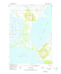
1951 Map of Ugashik C-3
USGS Topo · Published 1977About this map
Upper Ugashik Lake dominates this mid-century landscape of the Alaska Peninsula, where the waters of the upper and lower basins meet at a narrow channel. Surveyed in the early 1950s, the map reveals a vast wetland environment punctuated by the isolated heights of Blue Mountain and a secondary topographic point labeled Lone. The terrain is characterized by intricate swamp networks and countless small unnamed ponds that surround the larger bodies of Lower Ugashik Lake.
Find a feature on this map
7 named features on this map. Tap any name to fly to it.
Don’t see what you’re looking for? This feature index may not catch every label — zoom into the map to look around manually.
Map Details
Editions of this 1951 Ugashik C-3 Map
2 editions found
Other maps of this area

1943 · Ugashik
USGS Topo · 1:250,000

1948 · Ugashik
USGS Topo · 1:250,000

1949 · Ugashik
USGS Topo · 1:250,000

1951 · Ugashik C-4
USGS Topo · 1:63,360

1951 · Ugashik B-3
USGS Topo · 1:63,360

1951 · Ugashik C-2
USGS Topo · 1:63,360

1951 · Ugashik D-3
USGS Topo · 1:63,360

1951 · Ugashik D-4
USGS Topo · 1:63,360

1951 · Ugashik C-3
USGS Topo · 1:63,360

1951 · Ugashik D-2
USGS Topo · 1:63,360