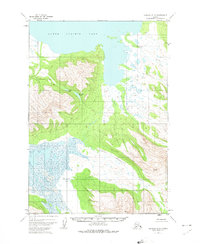
1951 Map of Ugashik B-3
USGS Topo · Published 1979About this map
Lower Ugashik Lake dominates the northern reaches of this coastal Alaskan landscape, where the waters of the Dog Salmon River flow through a complex system of wetlands and mountain foothills. Based on 1951 aerial photography, the map reveals a wilderness topography defined by intricate drainage patterns, notably the winding courses of Figure Eight Creek and Goblet Creek. A single isolated Cabin is marked near the edge of a massive swampy lowland, representing the only human structure recorded in this remote territory during the mid-twentieth century. The mapping of Elizabeth Lake and Lenora Lake tucked into the higher elevations illustrates the transition from the marshy coastal plain to the interior peaks. This survey serves as a fundamental record of the hydrography and terrain of the Alaska Peninsula before more modern developments, showing the natural state of Black Creek and the surrounding wilderness.
Find a feature on this map
8 named features on this map. Tap any name to fly to it.
Don’t see what you’re looking for? This feature index may not catch every label — zoom into the map to look around manually.
Map Details
Editions of this 1951 Ugashik B-3 Map
3 editions found
Other maps of this area

1943 · Ugashik
USGS Topo · 1:250,000

1948 · Ugashik
USGS Topo · 1:250,000

1949 · Ugashik
USGS Topo · 1:250,000

1951 · Ugashik C-4
USGS Topo · 1:63,360

1951 · Ugashik B-3
USGS Topo · 1:63,360

1951 · Ugashik C-2
USGS Topo · 1:63,360

1951 · Ugashik C-3
USGS Topo · 1:63,360

1951 · Ugashik A-2
USGS Topo · 1:63,360

1951 · Ugashik B-2
USGS Topo · 1:63,360

1954 · Ugashik A-3
USGS Topo · 1:63,360