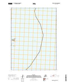
2019 Map of Ugashik A-2 OE E NW
USGS Topo · Published 2019About this map
Pacific Ocean waters dominate this coastal survey along the southeastern edge of the Alaska Peninsula. The shoreline is defined by the prominent Cape Kilokak and the sheltered indentation of Imuya Bay to the north. Just offshore, the Kilokak Rocks emerge as notable maritime hazards in an area where the marine environment remains the primary geographic influence. The map also delineates the maritime boundary of the Kodiak Island Borough, illustrating the administrative division between the mainland and the surrounding islands. The terrestrial portion is largely defined by the Public Land Survey System grids of t34s r44w and t35s r44w, showing a landscape primarily governed by natural features and maritime boundaries rather than established settlements.
Find a feature on this map
7 named features on this map. Tap any name to fly to it.
Don’t see what you’re looking for? This feature index may not catch every label — zoom into the map to look around manually.
Map Details
Editions of this 2019 Ugashik A-2 OE E NW Map
This is the sole edition of this map. No revisions or reprints were ever made.
Other maps of this area

1943 · Ugashik
USGS Topo · 1:250,000

1948 · Ugashik
USGS Topo · 1:250,000

1949 · Ugashik
USGS Topo · 1:250,000

1951 · Ugashik B-1
USGS Topo · 1:63,360

1951 · Ugashik A-2
USGS Topo · 1:63,360

1951 · Ugashik B-2
USGS Topo · 1:63,360

1963 · Ugashik
USGS Topo · 1:250,000
2019 · Ugashik A-2 NE
USGS Topo · 1:25,000
2019 · Ugashik B-1 SE
USGS Topo · 1:25,000
2019 · Ugashik B-2 SE
USGS Topo · 1:25,000