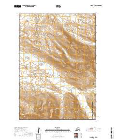
2019 Map of Ugashik B-3 SE
USGS Topo · Published 2019About this map
Figure Eight Creek and Goblet Creek define the drainage patterns of this remote Alaska Peninsula landscape, where water flows through complex topographic relief. The map documents the jurisdictional divide between the Lake and Peninsula Borough and the Kodiak Island Borough, a boundary that cuts through an area of extreme elevation changes and high ridges. This 2019 survey represents the modern terrain of the Ugashik B-3 SE quadrangle, emphasizing the natural hydrography that has shaped travel and subsistence in this region for generations. Researchers can trace the exact paths of these named creeks as they navigate the township and range lines of the Public Land Survey System, including t33s r47w and t33s r46w.
Find a feature on this map
9 named features on this map. Tap any name to fly to it.
Don’t see what you’re looking for? This feature index may not catch every label — zoom into the map to look around manually.
Map Details
Editions of this 2019 Ugashik B-3 SE Map
This is the sole edition of this map. No revisions or reprints were ever made.
Other maps of this area

1943 · Ugashik
USGS Topo · 1:250,000

1948 · Ugashik
USGS Topo · 1:250,000

1949 · Ugashik
USGS Topo · 1:250,000

1951 · Ugashik B-3
USGS Topo · 1:63,360

1951 · Ugashik A-2
USGS Topo · 1:63,360

1951 · Ugashik B-2
USGS Topo · 1:63,360

1954 · Ugashik A-3
USGS Topo · 1:63,360

1963 · Ugashik
USGS Topo · 1:250,000
2019 · Ugashik A-3 NE
USGS Topo · 1:25,000
2019 · Ugashik B-2 SW
USGS Topo · 1:25,000