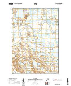
2019 Map of Ugashik C-4 SW
USGS Topo · Published 2019About this map
The Ugashik River winds through this expanse of the Alaska Peninsula, defining the drainage patterns of a landscape dominated by water. Flowing across the central portion of the survey, the river is fed by smaller tributaries like Andrew Creek in the northeast. This area within the Lake and Peninsula Borough is characterized by a dense network of small ponds and marshy depressions typical of the region's coastal tundra. While largely devoid of named settlements or infrastructure, the map provides a precise layout of the t30s r49w and t31s r49w township lines, reflecting the formal land division of this remote wilderness in the early twenty-first century.
Find a feature on this map
6 named features on this map. Tap any name to fly to it.
Don’t see what you’re looking for? This feature index may not catch every label — zoom into the map to look around manually.
Map Details
Editions of this 2019 Ugashik C-4 SW Map
This is the sole edition of this map. No revisions or reprints were ever made.
Other maps of this area

1943 · Ugashik
USGS Topo · 1:250,000

1948 · Ugashik
USGS Topo · 1:250,000

1949 · Ugashik
USGS Topo · 1:250,000

1951 · Ugashik C-5
USGS Topo · 1:63,360

1951 · Ugashik C-4
USGS Topo · 1:63,360

1954 · Ugashik B-4
USGS Topo · 1:63,360

1954 · Ugashik B-5
USGS Topo · 1:63,360

1963 · Ugashik
USGS Topo · 1:250,000
2019 · Ugashik C-4 NE
USGS Topo · 1:25,000
2019 · Ugashik C-5 SE
USGS Topo · 1:25,000