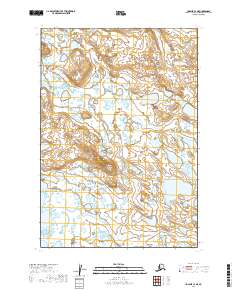
2019 Map of Ugashik C-4 NE
USGS Topo · Published 2019About this map
Andrew Creek and its tributary Andrew Cr wind through this remote Alaskan landscape, defining the hydrology of a region dominated by intricate wetlands and low-lying terrain. This 2019 survey, produced by the U.S. Geological Survey, meticulously documents the complex water patterns and shifting contours of the Lake and Peninsula Borough. The map relies on the Public Land Survey System to organize the expanse, clearly marking the boundaries of t28s r48w and t29s r48w. These surveying lines provide a critical spatial framework for understanding land distribution and natural drainage in a region where few permanent man-made landmarks exist, making the precise mapping of water bodies like Andrew Creek essential for navigation and environmental study.
Find a feature on this map
7 named features on this map. Tap any name to fly to it.
Don’t see what you’re looking for? This feature index may not catch every label — zoom into the map to look around manually.
Map Details
Editions of this 2019 Ugashik C-4 NE Map
This is the sole edition of this map. No revisions or reprints were ever made.
Other maps of this area

1943 · Ugashik
USGS Topo · 1:250,000

1948 · Ugashik
USGS Topo · 1:250,000

1949 · Ugashik
USGS Topo · 1:250,000

1951 · Ugashik C-4
USGS Topo · 1:63,360

1951 · Ugashik D-3
USGS Topo · 1:63,360

1951 · Ugashik D-4
USGS Topo · 1:63,360

1951 · Ugashik C-3
USGS Topo · 1:63,360

1963 · Ugashik
USGS Topo · 1:250,000
2019 · Ugashik C-4 SW
USGS Topo · 1:25,000
2019 · Ugashik D-4 SE
USGS Topo · 1:25,000