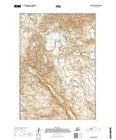
2019 Map of Ugashik D-4 SE
USGS Topo · Published 2019About this map
Andrew Creek meanders through a landscape defined by an extensive network of unnamed ponds and marshes within the Lake and Peninsula Borough. This 2019 survey documents a wilderness environment where water dominates the geography, showing the intricate hydrological patterns of the Alaska Peninsula. The map is primarily organized by the Public Land Survey System, detailing the intersections of t27s r48w, t27s r47w, t28s r48w, and t28s r47w. This remote area remains largely untouched by modern infrastructure, providing a clear record of the natural terrain and drainage basins as they existed in the early 21st century.
Find a feature on this map
5 named features on this map. Tap any name to fly to it.
Don’t see what you’re looking for? This feature index may not catch every label — zoom into the map to look around manually.
Map Details
Editions of this 2019 Ugashik D-4 SE Map
This is the sole edition of this map. No revisions or reprints were ever made.
Other maps of this area

1943 · Ugashik
USGS Topo · 1:250,000

1948 · Ugashik
USGS Topo · 1:250,000

1949 · Ugashik
USGS Topo · 1:250,000

1951 · Ugashik C-4
USGS Topo · 1:63,360

1951 · Ugashik D-3
USGS Topo · 1:63,360

1951 · Ugashik D-4
USGS Topo · 1:63,360

1951 · Ugashik C-3
USGS Topo · 1:63,360

1963 · Ugashik
USGS Topo · 1:250,000
2019 · Ugashik C-4 NE
USGS Topo · 1:25,000
2019 · Ugashik D-3 NW
USGS Topo · 1:25,000