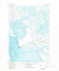
1951 Map of Ugashik C-5
USGS Topo · Published 1975About this map
Pilot Point and the coastal settlement of Ugashik anchor this mid-century survey of the Alaska Peninsula coastline. The landscape is defined by the massive Tidal Flat regions bordering Ugashik Bay, where the saltwater meets the outflow of the Ugashik River. This era shows a focused maritime and aviation infrastructure necessary for the region's salmon industry, with a Cannery, Water Tower, and a remote Landing Strip serving as the primary links to the outside world.
Find a feature on this map
11 named features on this map. Tap any name to fly to it.
Don’t see what you’re looking for? This feature index may not catch every label — zoom into the map to look around manually.
Map Details
Editions of this 1951 Ugashik C-5 Map
2 editions found
Other maps of this area

1943 · Ugashik
USGS Topo · 1:250,000

1948 · Ugashik
USGS Topo · 1:250,000

1949 · Ugashik
USGS Topo · 1:250,000

1951 · Ugashik C-5
USGS Topo · 1:63,360

1951 · Ugashik C-4
USGS Topo · 1:63,360

1951 · Ugashik D-5 and D-6
USGS Topo · 1:63,360

1951 · Ugashik D-4
USGS Topo · 1:63,360

1951 · Ugashik C-6
USGS Topo · 1:63,360

1954 · Ugashik B-4
USGS Topo · 1:63,360

1954 · Ugashik B-5
USGS Topo · 1:63,360