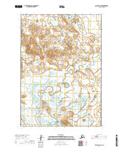
2019 Map of Ugashik C-5 NW
USGS Topo · Published 2019About this map
Subarctic wetlands and complex hydrography characterize this remote portion of the Alaska Peninsula. The landscape is defined by an intricate network of unnamed lakes and meandering watercourses, suggesting a highly dynamic environment shaped by seasonal thaw and alluvial processes. Lacking established settlements or roads, the area is delineated by the Public Land Survey System grids of T28s R51w, T28s R50w, and T29s R51w. The absence of human infrastructure highlights the primary role of this 2019 survey in documenting environmental and topographic baselines for conservation and geological study in Lake and Peninsula Borough.
Find a feature on this map
5 named features on this map. Tap any name to fly to it.
Don’t see what you’re looking for? This feature index may not catch every label — zoom into the map to look around manually.
Map Details
Editions of this 2019 Ugashik C-5 NW Map
This is the sole edition of this map. No revisions or reprints were ever made.
Other maps of this area

1943 · Ugashik
USGS Topo · 1:250,000

1948 · Ugashik
USGS Topo · 1:250,000

1949 · Ugashik
USGS Topo · 1:250,000

1951 · Ugashik C-5
USGS Topo · 1:63,360

1951 · Ugashik D-5 and D-6
USGS Topo · 1:63,360

1951 · Ugashik C-6
USGS Topo · 1:63,360

1963 · Ugashik
USGS Topo · 1:250,000
2019 · Ugashik C-5 SE
USGS Topo · 1:25,000
2019 · Ugashik C-5 SW
USGS Topo · 1:25,000
2019 · Ugashik C-6 SE
USGS Topo · 1:25,000