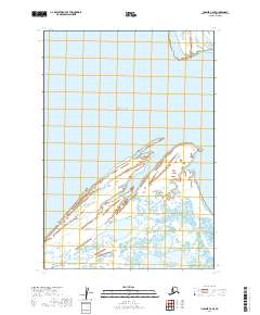
2019 Map of Ugashik C-6 SE
USGS Topo · Published 2019About this map
Bristol Bay dominates this coastal survey, where the waters of Ugashik Bay meet the northern shore of the Alaska Peninsula. The landscape is defined by the shifting interface of water and land, characterized by the prominent headland at Cape Menshikof and the northern reach of Smoky Point. This area, within the Lake and Peninsula Borough, showcases the complex hydrography and wetland patterns typical of the region's estuarine environments. The map preserves the exact coastal geometry and land-survey boundaries of the early 21st century, serving as a record of the shoreline before further natural erosion or sediment shifts. Geographers and coastal researchers can trace the intricate network of tidal flats and inlets that stretch inland from the bay, revealing the uninhabited but ecologically significant character of this remote maritime reach.
Find a feature on this map
8 named features on this map. Tap any name to fly to it.
Don’t see what you’re looking for? This feature index may not catch every label — zoom into the map to look around manually.
Map Details
Editions of this 2019 Ugashik C-6 SE Map
This is the sole edition of this map. No revisions or reprints were ever made.
Other maps of this area

1943 · Ugashik
USGS Topo · 1:250,000

1948 · Ugashik
USGS Topo · 1:250,000

1949 · Ugashik
USGS Topo · 1:250,000

1951 · Ugashik C-5
USGS Topo · 1:63,360

1951 · Ugashik C-6
USGS Topo · 1:63,360

1954 · Ugashik B-5
USGS Topo · 1:63,360

1963 · Ugashik B-6
USGS Topo · 1:63,360

1963 · Ugashik
USGS Topo · 1:250,000
2019 · Ugashik C-5 NW
USGS Topo · 1:25,000
2019 · Ugashik B-5 NW
USGS Topo · 1:25,000