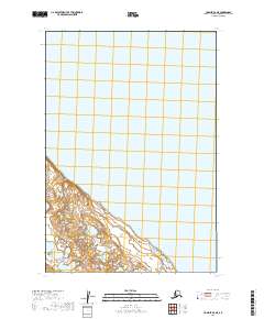
2019 Map of Ugashik D-3 NE
USGS Topo · Published 2019About this map
Becharof Lake dominates this portion of the Alaska Peninsula, its vast waters covering the majority of the landscape depicted in this 2019 survey. The shoreline along the southern edge of the sheet reveals a complex network of wetlands and small coastal ponds, captured in detail by the U.S. Geological Survey using imagery from 2009. The map is defined primarily by its aquatic boundaries and the Public Land Survey System grid, including segments of t25s r46w and t26s r46w. While largely devoid of named settlements or man-made infrastructure, the map provides a precise record of the lake's reach and the shifting topography of its southern banks within the Lake and Peninsula Borough.
Find a feature on this map
7 named features on this map. Tap any name to fly to it.
Don’t see what you’re looking for? This feature index may not catch every label — zoom into the map to look around manually.
Map Details
Editions of this 2019 Ugashik D-3 NE Map
This is the sole edition of this map. No revisions or reprints were ever made.
Other maps of this area

1943 · Ugashik
USGS Topo · 1:250,000

1948 · Ugashik
USGS Topo · 1:250,000

1949 · Ugashik
USGS Topo · 1:250,000

1951 · Ugashik D-3
USGS Topo · 1:63,360

1951 · Naknek A-2
USGS Topo · 1:63,360

1951 · Ugashik D-2
USGS Topo · 1:63,360

1951 · Naknek A-3
USGS Topo · 1:63,360

1952 · Naknek
USGS Topo · 1:250,000

1963 · Ugashik
USGS Topo · 1:250,000

1964 · Naknek
USGS Topo · 1:250,000