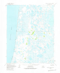
1951 Map of Ugashik D-5 and D-6
USGS Topo · Published 1975About this map
Bristol Bay dominates the western edge of this coastal Alaskan landscape, where a sprawling Tidal Flat meets an intricate network of wetlands and tundra ponds. Based on 1951 aerial photography, the map reveals a remote environment largely devoid of permanent infrastructure, save for a lone Cabin located in the eastern interior. The terrain is marked by numerous survey stations, including VABM 169 Ernie, VABM 198 Vixen, and VABM 17 King, which serve as the primary landmarks in an area of low relief.
Find a feature on this map
12 named features on this map. Tap any name to fly to it.
Don’t see what you’re looking for? This feature index may not catch every label — zoom into the map to look around manually.
Map Details
Editions of this 1951 Ugashik D-5 and D-6 Map
2 editions found
Other maps of this area

1943 · Ugashik
USGS Topo · 1:250,000

1948 · Ugashik
USGS Topo · 1:250,000

1949 · Ugashik
USGS Topo · 1:250,000

1951 · Ugashik C-5
USGS Topo · 1:63,360

1951 · Ugashik C-4
USGS Topo · 1:63,360

1951 · Ugashik D-5 and D-6
USGS Topo · 1:63,360

1951 · Ugashik D-4
USGS Topo · 1:63,360

1951 · Naknek A-5
USGS Topo · 1:63,360

1951 · Naknek A-4
USGS Topo · 1:63,360

1951 · Ugashik C-6
USGS Topo · 1:63,360